|
|
|||||||||||||||||||||||||||||||||||||||||||||||||||||||||||||||||||
|
|
|||||||||||||||||||||||||||||||||||||||||||||||||||||||||||||||||||
The Inca TrailLocation: Rediscover Machu Picchu > The Inca Civilization > The Inca Trail -----------------------------------------------------------------------------------------------------------------------------------------------------------------------------------------------------------------
The Path that Once Linked the Inca Cities
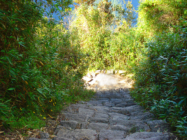
The Inca Trail has carefully put-together rock stairs
The Inca Trail is a wonderful treasure of construction. This pathway was constructed over 500 years ago and much of it is still in place today.
The trail system stretches like veins across the northwestern parts of South America, starting north of Ecuador's capital, Quito, then going down to Peru and Bolivia, then further down into south of Santiago, the Chilean Capital.
Heights where trails had been built reach higher than 5.000 m (16,400 ft).
Some specialists affirm that these chasquis could run dozens of kilometers/miles a day. This is impossible for a modern day runner to achieve the performance of these ancient Inca runners. They were used to high altitude conditions and were well-trained.
A chasqui transmitted messages by carrying knotted-cords, ropes that had different colour knotted ropes tied on them. These were called quipus. Each wire colour and each knot combination or distance between knots had a meaning. This way, the Incas could communicate without writing.
Unfortunately many of these quipus were burnt by the Spaniards following the conquest, because they were non-Christian.
The tambos were places where food and drinks were stored: corn, dried potatoes were among the main provisions kept in these places. Aqueducts, fountains were found near them, which ensured drinking water. Fruit trees were planted along the road, especially in the proximity of the tambos in order to ensure fresh food.
The Inca Trail to Machu Picchu
Hiking to Machu Picchu usually takes 4 days on the most common itinerary, on the long Inca Trail. This one is only a small section of the great Inca road system.
Some mistakenly think that this is in fact THE Inca Trail. No, it is just a very tiny part of the 23.000 km long network! It is though, the most well-preserved part. Workers are struggling to keep it that way.
The average height of the Inca Trail in the Urubamba Valley area is of about 2.500 m (8.200 ft) from sea level. If you would like to hike on this segment, then make sure that you are well-prepared physically and mentally as well.
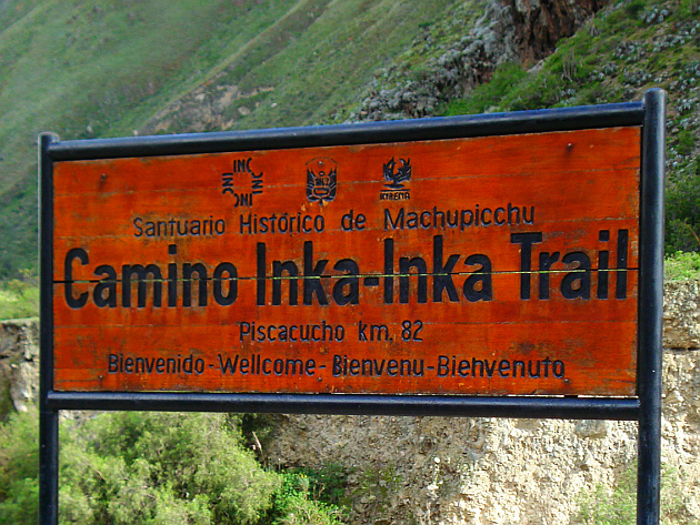
Inca Trail Sign Welcoming the Hikers
The Past, Purpose, Characteristics of the Inca Trail
The ancient road network's purpose was primarily to help communication between different parts of the Inca Empire. This was done with the help of the Inca runners, the above mentioned chasquis. If something happened in one part of the Inca Empire, then the chasquis would bring the message across to other parts. If there was war, they could run for help.
The most important cities were linked together with this trail network, which converged in Cuzco. Interestingly the saying "all roads lead to Rome" (referring to the Roman Empire's vast road network) can also be told about the Inca Trail network: "all roads lead to Cuzco".
For the conquistadores it wasn't hard to find one Inca city after the other, because they were all linked by this trail. Theoretically, the could have found Machu Picchu, but fortunately for the wonderful city, the conquistadores never found the Inca Trail leading to it!
The Inca Trail is still functional in many places, but in others it has almost disappeared. Part of it is covered with rocks and looks quite solid, but most of it is just a dust trail. Or at least is was, because much of it was covered by vegetation and was washed away by rain and mudflows.
The width of the trail varies from 1 to 2 meters.
Some sections had rope-suspended bridges that linked the trail segments above valleys, rivers. Of course, today there are newer bridges in these areas.
Related Material-----------------------------------------------------------------------------------------------------------------------------------------------------------------------------------------------------------------
|
|
||||||||||||||||||||||||||||||||||||||||||||||||||||||||||||||||||
|
|
|||||||||||||||||||||||||||||||||||||||||||||||||||||||||||||||||||
|
|
|||||||||||||||||||||||||||||||||||||||||||||||||||||||||||||||||||
|
|
|||||||||||||||||||||||||||||||||||||||||||||||||||||||||||||||||||
|
|||||||||||||||||||||||||||||||||||||||||||||||||||||||||||||||||||
|
|
|||||||||||||||||||||||||||||||||||||||||||||||||||||||||||||||||||